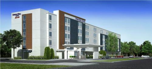
Marbledale Road Hotel & Restaurant

109 Marbledale Avenue, Tuckahoe, NY

April 4, 2017

To date, the remedial excavation of Source Areas 3, 6-11 have been completed and backfilled.

Work on Source Areas 1, 2 and 4 have been commenced. Additional excavation is required at Source Area 2 based on endpoint data, and additional work is needed at SA-1 (following underground storage tank removal – see below) and SA-4 (pending waste classification approvals as this area was noted to contain cosmetic debris).; Source Area 5, based on review of all soil pre-characterization data reviewed and approved by the NYSDEC, does not require soil excavation and off-site disposal.

All Source Area removal work is completed in accordance with the RAWP and the Scope of Work(s) finalized after NYSDEC and HDR review and approval.  The CAMP monitors (minimum of 5) were all active during remediation and no elevated levels were observed during Source Area removal, or any other work (including grading or other soil movements) .  On several occasions, additional CAMP monitors were used to monitor work activities conducted in two areas of the site concurrently.

Monitoring in and around each Source Area and grading  work– with NYSDEC and HDR staff being present on-site – also did not note anything unusual in terms of instrument readings or significant odors. Source material and debris were observed (SA-3, SA-4) and appropriately removed, containerized, and are awaiting appropriate off-site disposal.  As part of the Source Area scope, some additional testpit work will be conducted to evaluate if more source material is present in shallow soils at the site.

On March 15th, the Village issued a Grading permit for additional site work.  This includes importing materials and screening on-site surface soils for possible use as backfill for remediated Source Areas. Even though the surface soil screening is only to depths of approximately 6” to 2 or 3 ft. below grade, air monitoring at these work locations and the necessary number of  CAMP stations have been and will remain active.

Two 2,000 gallon Underground Storage Tanks (UST’s) were uncovered in the northern section of SA-1 on March 6, 2017.  Work to remove the remaining liquid from the tanks via a vacuum truck was conducted on Friday March 31st, a total of 2091 gallons of fuel / water-fuel mix were removed from the tanks for disposal.  The tanks were removed from the ground and taken off-site for disposal/metal recycling on Monday, April 3rd.  All work involving the USTs was performed by a licensed UST removal specialist in accordance with the NYSDEC and Westchester County Department of Health (WCDOH) regulations.  

On Friday, March 31st a permit was issued, after NYSDEC and HDR review and approval of a work scope, for an on-site Pilot Test to evaluate the proposed Micropiling procedures in the building footprint.  Field observations during this 3-5 day pilot will dictate final review, conditions, and approval for the micropile and foundation scope of work.  Pilot test to commence the week of April 3rd.  All work monitored by NYSDEC and HDR and CAMP stations will remain active around the pilot work.

Documents:

AttachmentSize
PDF icon Community Meeting Presentation #13 - October 11, 20174.33 MB
PDF icon Decision & Order Article 78222.71 KB
PDF icon Pile Foundation RIC Scope8.89 MB
PDF icon Grading Scope3.35 MB
PDF icon Ecosystems Ambiant Air Quality Report - March 22, 20173.31 MB
PDF icon Knauf Shaw Response to Mayor - April 3, 2017144.5 KB
PDF icon Knauf Shaw Response to Mayor - March 20, 2017209.47 KB
PDF icon Mayoral Request to Knauf Shaw596.55 KB
PDF icon Community Meeting Video Links42.23 KB
PDF icon Source Area Removal Scope of Work25.31 MB
PDF icon Source Area 2 Scope of Work13.33 MB
PDF icon DEC Source Area 2 Approval204.75 KB
PDF icon DEC Comments Former Marble Quarry346.67 KB
PDF icon Dioxin Testing Summary and Tables2.84 MB
PDF icon Environmental Investigation Draft Summary Tables5.39 MB
PDF icon Draft Sample Location Map1.03 MB
PDF icon Community Meeting Presentation #12 June 28th4.82 MB
PDF icon Community Meeting Presentation #11 May 24th5.73 MB
PDF icon Community Meeting Presentation #10 April 26th2.93 MB
PDF icon Community Meeting Presentation #9 March 29th614.12 KB
PDF icon Community Meeting Presentation #8 March 8th17.26 MB
PDF icon Community Meeting Presentation #7 Feb. 22nd 6.32 MB
PDF icon Community Meeting Presentation #6 Feb. 8th 3.54 MB
PDF icon Community Meeting Presentation #5 Jan. 25th 522.77 KB
PDF icon Community Meeting Presentation #4 Jan. 11th 1.91 MB
PDF icon Community Meeting Presentation #3 Dec. 14th1.93 MB
PDF icon Community Meeting Presentation #2 Nov. 30th8.08 MB
PDF icon Community Meeting Presentation #1 Nov. 16th6.73 MB
PDF icon EPA Response to Congressman Eliot Engel839.58 KB
PDF icon Final Planning Board Resolution7.41 MB
PDF icon Gaming Commission Response to Mayor Inquiry 378.83 KB
PDF icon Radiation Screening Results - Letter dated Oct. 17, 2016322.55 KB
PDF icon Final Scope of Work for Pre-Charaterization Sampling3.93 MB
PDF icon DEC Letter response to Assemblywomen Paulin and Senator Latimer144.41 KB
PDF icon FINAL - RAWP (399 Pages)84.55 MB
PDF icon Decision Document July 20164.85 MB
PDF icon DEC Question & Answer Document regarding Selected Remedy164.93 KB
PDF icon HDR (Village Consultant) comments on applicants draft RAWP71.65 KB
PDF icon Remedy Proposed for Brownfield Site Contamination; Public Comment Period and Public Meeitng Announced558.32 KB
PDF icon March 2016 RIR Fact Sheet393.21 KB
PDF icon Final Remedial Investigation Report (Part 1 - 500 pages)7.72 MB
PDF icon Final Remedial Investigation Report (Part 2)2.53 MB
PDF icon Private Propety Environmental Sampling248.79 KB
PDF icon Draft Remedial Action Work Plan (DRAWP)761.89 KB
PDF icon DRAWP - Appendix A318.44 KB
PDF icon DRAWP - Figures32.67 MB
PDF icon DRAWP - Tables429.77 KB
PDF icon Final Decision Document81.05 KB
PDF icon Comprehensive Planning Board Minutes - Hotel Application107.71 KB
PDF icon Comprehensive Zoning Board Minutes - Hotel Application29.76 KB
PDF icon Phase I ESA Report - 109/125 Marbledale Road Sept. 6, 20133.3 MB
PDF icon Phase II ESA Report - 109/125 Marbledale Road Jan. 20147.28 MB
PDF icon CAMP Data Summary - September 20177.46 MB
PDF icon CAMP Data Summary - August 1 - 18 201712.27 MB
PDF icon CAMP Data Summary - July 201723.54 MB
PDF icon CAMP Data Summary - June 201725.44 MB
PDF icon CAMP Data Summary - May 201713.64 MB
PDF icon CAMP Data Summary - April 20178.2 MB
PDF icon CAMP Data Summary - March 20173.93 MB
PDF icon CAMP Data Summary - January and February 20173.47 MB
PDF icon CAMP Summary Data - November and December 20162.75 MB
PDF icon CAMP Summary Data - October 20162.56 MB
PDF icon How to interpret CAMP Data and summary for Sept. 27 - 301.38 MB